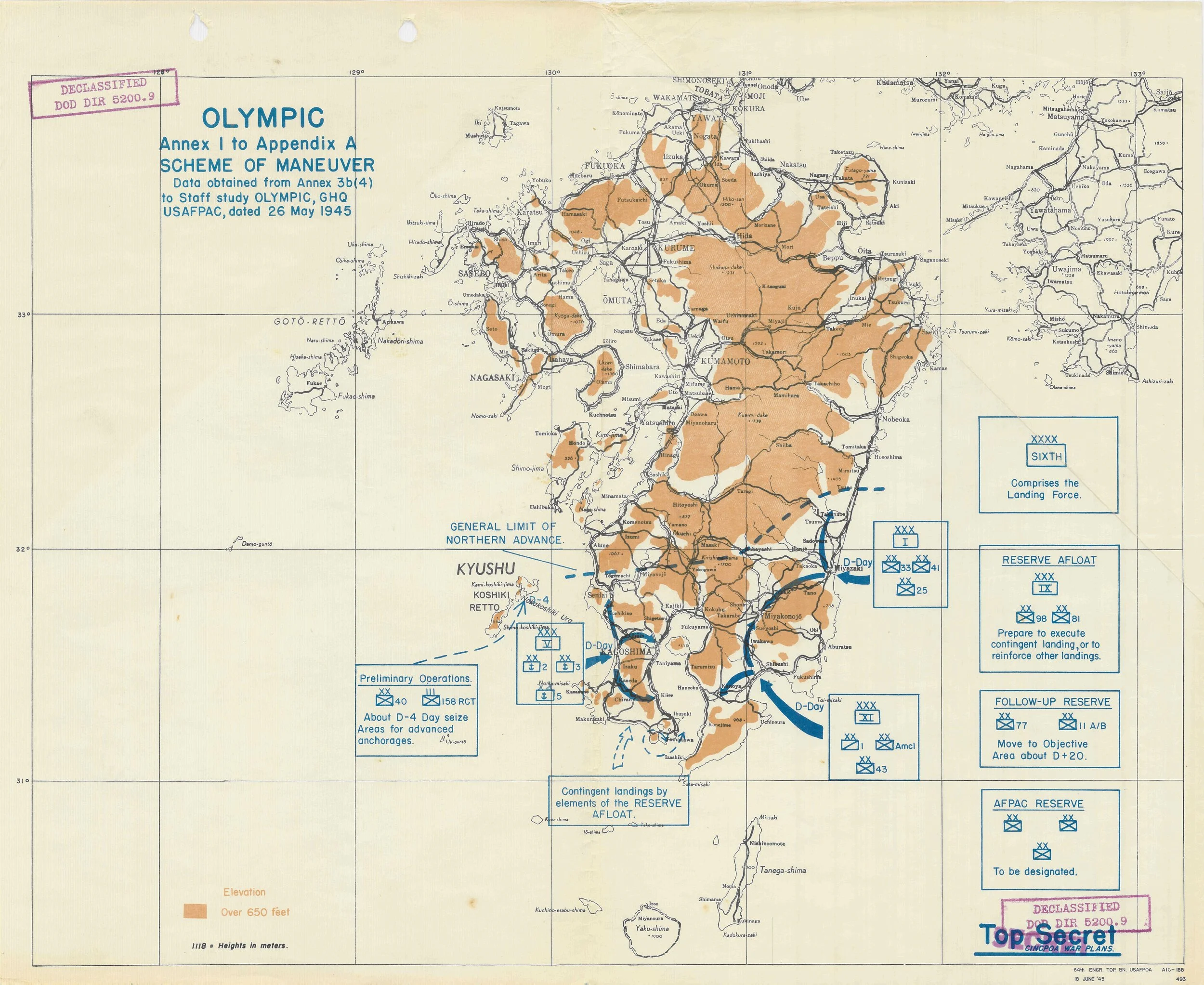
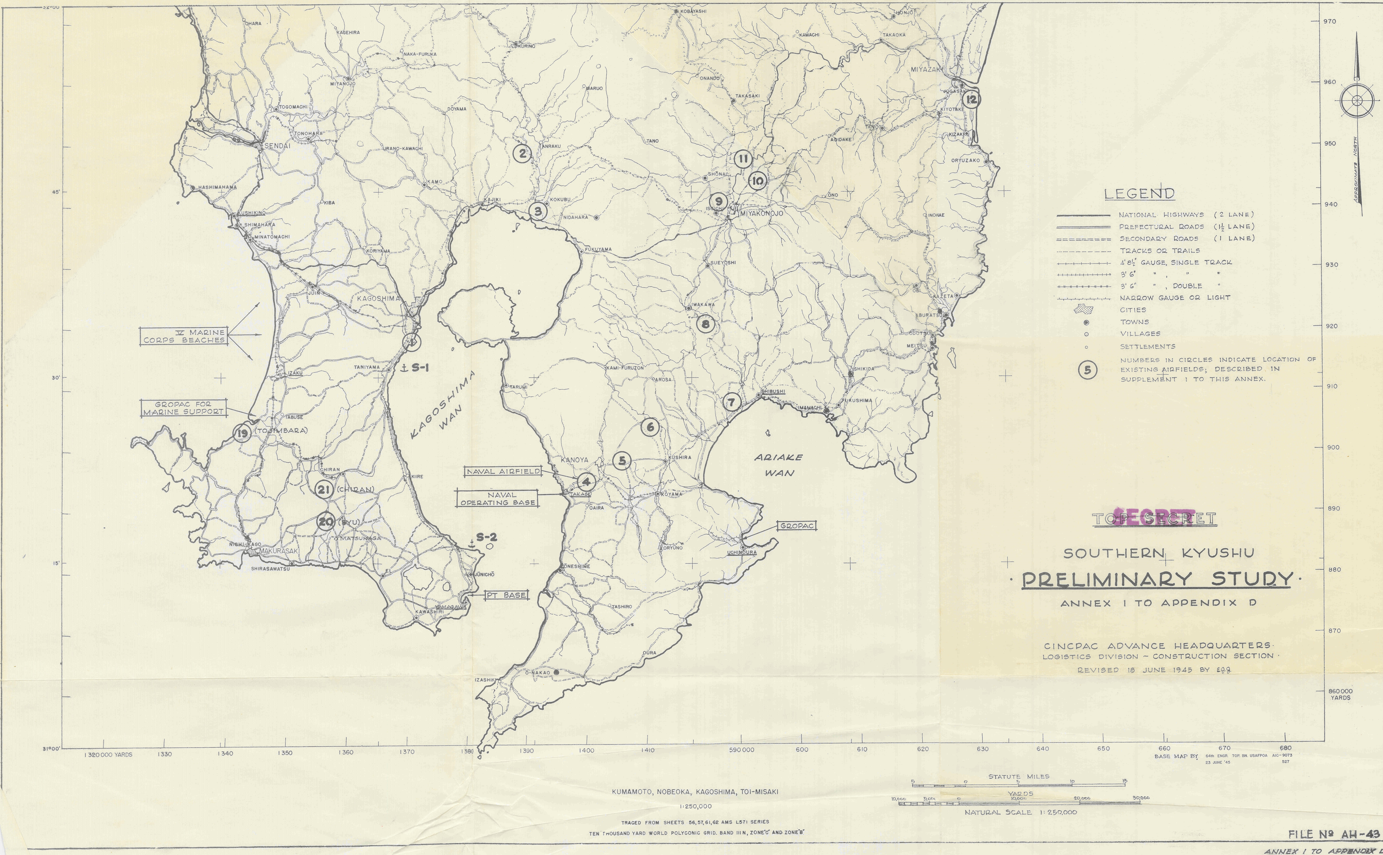
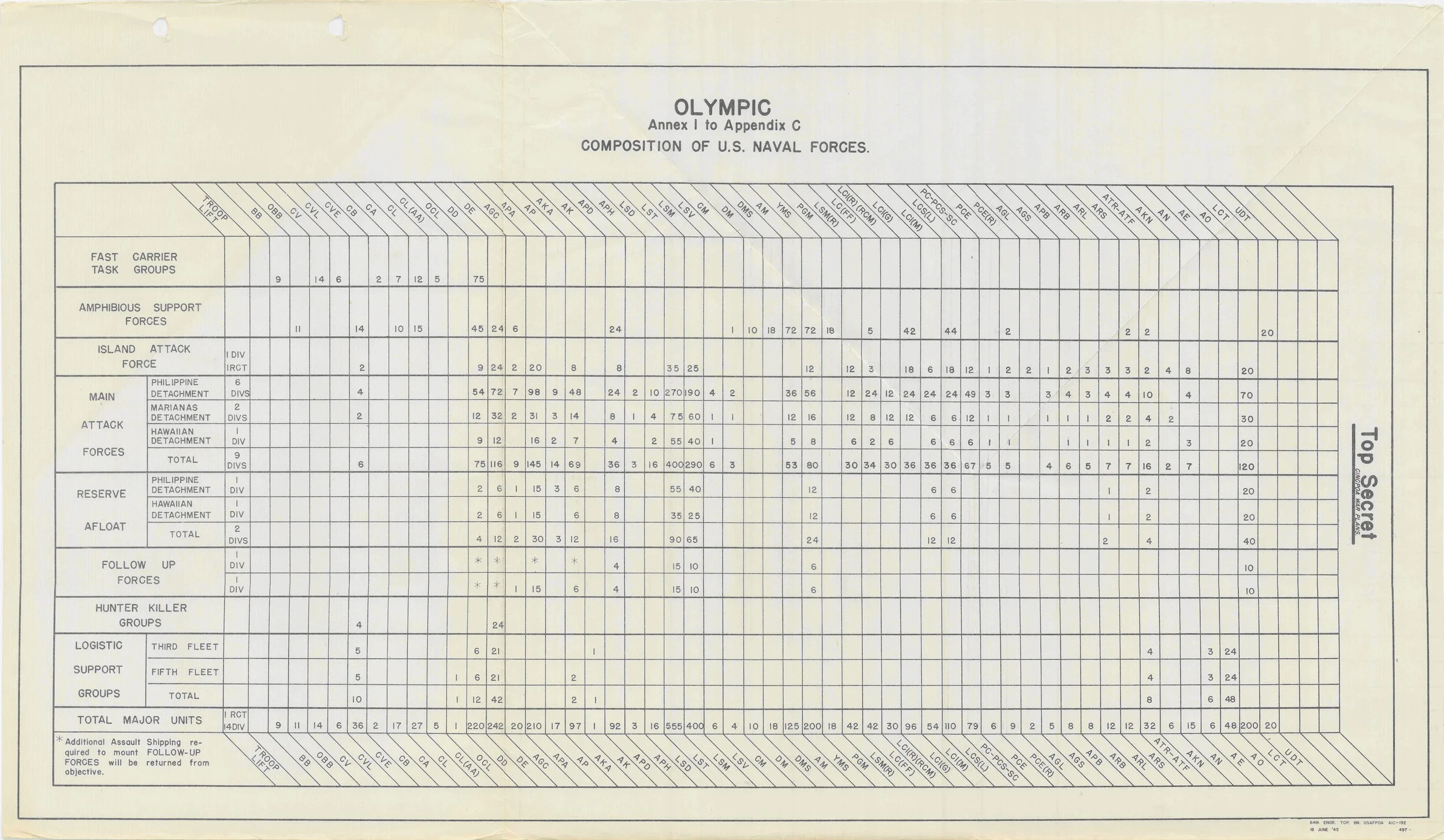
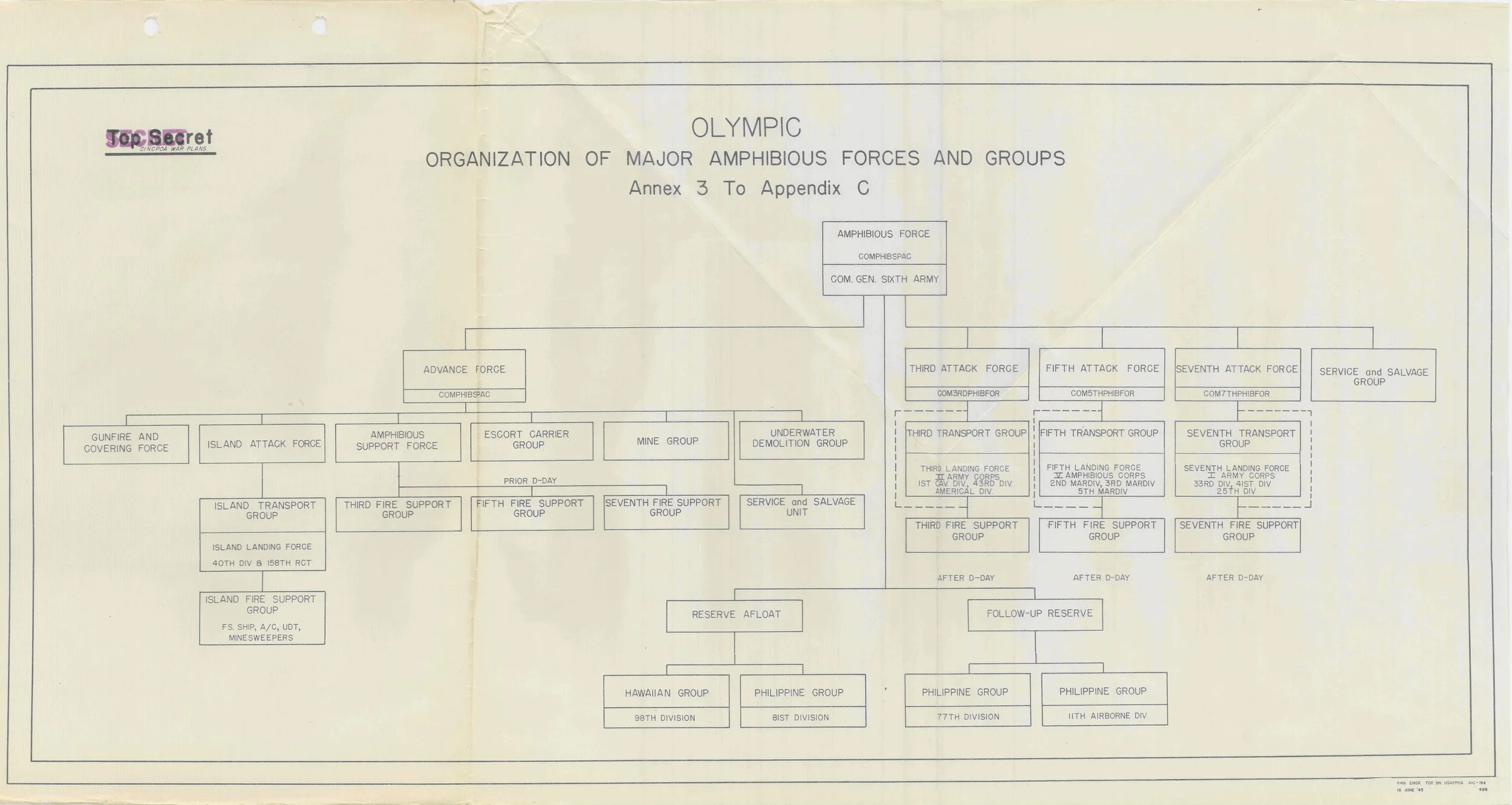
NAVY PLANNING GRAPHICS

The following graphics are from the Navy’s planning documents. They illustrate the organization of the naval forces and groups as well as the scheme of maneuver. The fourth graphic shows location of key airfields, the ultimate objective of OPERATION OLYMPIC.

Historical military map of Japan from 1945, showing regions, roads, and elevation levels with annotations about troop movements and strategic planning during World War II.
A historical map of southern Kyushu, Japan, from a 1945 military study, showing roads, airfields, and military installations, with location markers and a legend.
A historical U.S. Navy military chart showing the composition of naval forces, including task groups, support forces, island attack forces, main attack forces, reserve forces, afloat forces, follow-up forces, hunter-killer groups, and logistic support groups with columns of military unit abbreviations and numerical data.
A detailed organizational chart of major amphibious forces and groups for an Olympic military plan, including various specific units and support groups.